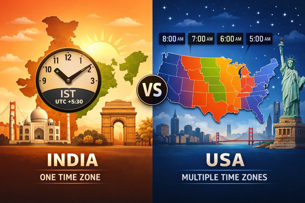
Time is measured everywhere, but countries do not organize it in exactly the same way.
One of the most interesting examples is the difference between India and the United States. India is a geographically large country that stretches a considerable distance from east to west, yet the entire country officially follows a single time zone: Indian Standard Time (IST), UTC+5:30.
The United States, by comparison, uses multiple time zones across its territory. The country's mainland alone stretches thousands of kilometers from east to west, creating substantial differences in sunrise, sunset, and local solar time.
At first glance, the explanation seems simple: the United States is wider from east to west, so it needs more time zones.
But geography is only part of the story.
Time zones are also shaped by history, politics, transportation, administration, economics, daylight patterns, and national policy. The boundaries people see on a time-zone map are therefore not simply lines drawn every 15 degrees of longitude.
So why does India use one official time zone while the United States uses several?
The answer is a combination of geography and political choice.
What Is a Time Zone?
A time zone is a region that observes the same standard time.
The concept comes from Earth's rotation.
Earth rotates approximately 360 degrees in about 24 hours. Dividing 360 degrees by 24 hours gives approximately 15 degrees of longitude per hour.
This provides the basic geographical idea behind time zones:
15 degrees of longitude ≈ 1 hour of time difference
However, actual time-zone boundaries rarely follow perfect 15-degree lines.
Countries and territories adjust their time-zone boundaries according to practical and political considerations.
Time zones may be influenced by:
- National borders
- State or provincial boundaries
- Transportation networks
- Economic relationships
- Administrative convenience
- Historical decisions
- Population distribution
- Political considerations
- Daylight patterns
As a result, a time-zone map is partly a geographical map and partly a political and administrative map.
Solar Time vs. Standard Time
Before standardized time zones became common, communities often relied on local solar time.
Solar noon occurs approximately when the Sun reaches its highest point in the sky. Because Earth rotates continuously, solar noon occurs at different moments at different longitudes.
For example, a location farther east experiences sunrise and solar noon earlier than a location farther west.
This works reasonably well for local life, but it creates problems when people need to coordinate across large distances.
Imagine a railway timetable using the local solar time of every city along a route.
Passengers and railway operators would have to constantly adjust their watches.
The development of railways and long-distance communication made standardized time increasingly important.
Time zones provided a practical solution.
Why Are Time Zones Usually About One Hour Apart?
The 24-hour day provides the basic framework.
Since Earth rotates approximately 360 degrees in 24 hours:
360 ÷ 24 = 15 degrees per hour
This means that every 15 degrees of longitude corresponds approximately to one hour of solar-time difference.
In an idealized world, Earth could be divided into 24 equal time zones.
Real-world time zones, however, are not so neat.
Political boundaries often take priority over geographical symmetry.
That is why some countries use a single time zone despite spanning several theoretical zones, while others use several time zones.
Why Does India Have One Time Zone?
India officially uses Indian Standard Time (IST) throughout the country.
IST is UTC+5:30.
The standard time is based on the 82.5° east longitude, which passes through the vicinity of Mirzapur in Uttar Pradesh.
The choice of a single national time was influenced by India's history and the practical advantages of having one national standard.
1. National Standardization
One of the biggest advantages of a single national time is simplicity.
Whether someone is in:
- Gujarat
- Maharashtra
- Delhi
- Uttar Pradesh
- West Bengal
- Assam
- Arunachal Pradesh
the official clock time is based on the same national standard.
This makes national schedules easier to communicate.
A television program, government announcement, examination, railway timetable, or nationwide business meeting can use one official time without specifying different times for different parts of the country.
2. Historical Experience With Local Times
During the colonial period, different parts of India used different local or regional time standards.
Historically, places such as Bombay and Calcutta had their own local times, while railway and administrative systems increasingly needed standardized time.
The development of railways made time coordination especially important.
A train traveling across long distances cannot operate efficiently if every location uses a different local solar time.
Standardized time therefore became an important administrative tool.
3. A Central Reference Meridian
India's standard time is based on 82.5°E longitude.
This meridian was selected as a national reference because it provides a practical central reference for the country.
It does not mean that 82.5°E is the point where the Sun is directly overhead whenever Indian clocks show noon.
Standard time is a fixed civil-time system, while solar time varies continuously with longitude.
The difference between official clock time and local solar time therefore changes depending on where you are in India.
India's Geographic Challenge
India's decision to use one time zone also creates an interesting geographical problem.
The country extends a long distance from east to west.
As a result, sunrise occurs considerably earlier in the northeast than in western India.
For people living in eastern and northeastern regions, the Sun can rise relatively early according to the official clock.
In western India, sunrise can occur later according to the same clock.
This means that one national time zone does not produce identical daylight patterns everywhere.
Why Does This Matter?
Human activity is strongly connected to daylight.
Traditional work and agricultural activities often begin in relation to sunrise.
When the official clock does not closely match local solar time, people can adjust their daily schedules rather than changing the national time standard.
For example, a workplace could begin earlier in the morning without requiring the country to create a separate official time zone.
This is one reason the time-zone debate in India is more complicated than simply asking whether another time zone would "save time."
The Debate Over a Second Time Zone in India
India has periodically discussed whether the country should introduce an additional time zone, particularly for the northeastern region.
The argument is largely based on the difference between official clock time and daylight.
Arguments in Favor
Supporters of an additional time zone have argued that a separate regional time could better align working hours with daylight.
Potential advantages could include:
- Better use of morning daylight
- Different work schedules suited to local conditions
- Potential reductions in lighting use in some circumstances
- Greater alignment between local solar time and daily activities
The argument is especially relevant in areas where sunrise occurs much earlier than typical working hours.
Arguments Against
Creating another official time zone would also introduce additional complexity.
Potential challenges include:
- Railway scheduling
- Airline operations
- Government coordination
- Broadcasting schedules
- Business meetings
- Digital systems
- Cross-border communication
- Public confusion
A country using two official times would need clear rules about where the boundary lies and how national institutions should handle the difference.
For a country with a large population and highly interconnected transportation and communication systems, these issues matter.
Why the Northeast Is Different
The northeastern region of India is particularly important in the time-zone debate.
Because it lies considerably farther east than the national standard meridian, its solar time is ahead of IST.
The Sun therefore rises earlier according to the official clock than it does in many western parts of the country.
This has led to discussions about whether the region should use a different standard time.
However, daylight can also be addressed through local schedules without changing the official time zone.
This distinction is important:
Changing working hours is not the same thing as changing the national time zone.
A region can begin offices, schools, factories, or other activities earlier while still using IST.
Why Does the United States Have Multiple Time Zones?
The United States provides a very different example.
The country covers a huge east-west area, particularly when its mainland and non-contiguous states are considered.
Different parts of the United States experience significantly different solar times.
The country therefore uses multiple standard time zones.
For the contiguous United States, the major zones are:
- Eastern Time
- Central Time
- Mountain Time
- Pacific Time
The United States also has:
- Alaska Time
- Hawaii–Aleutian Time
There are additional distinctions and local variations within U.S. territories and specific jurisdictions, so simply saying that the entire United States has "six time zones" can be an oversimplification.
For everyday discussion, however, the six major named zones listed above are commonly used to describe the country's principal time-zone system.
The Four Main U.S. Time Zones Across the Contiguous States
Eastern Time
Eastern Time covers much of the eastern United States.
Major cities include:
- New York
- Washington, D.C.
- Boston
- Atlanta
- Miami
Eastern Time is generally UTC−5 during standard time and UTC−4 during daylight saving time where DST is observed.
Central Time
Central Time covers a broad area between the Eastern and Mountain zones.
Major cities include:
- Chicago
- Dallas
- Houston
- New Orleans
- Minneapolis
Central Time is generally UTC−6 during standard time and UTC−5 during daylight saving time where applicable.
Mountain Time
Mountain Time covers parts of the western interior United States.
Examples include areas around:
- Denver
- Salt Lake City
- Albuquerque
- Phoenix region, with important local exceptions
Mountain Time is generally UTC−7 during standard time and UTC−6 during daylight saving time where observed.
Arizona is an important exception because most of the state does not observe daylight saving time.
Pacific Time
Pacific Time covers the western coastal region.
Major cities include:
- Los Angeles
- San Francisco
- Seattle
- Portland
- San Diego
Pacific Time is generally UTC−8 during standard time and UTC−7 during daylight saving time where observed.
Why Geography Makes Multiple U.S. Time Zones Practical
The main geographical reason for multiple U.S. time zones is the country's enormous east-west extent.
If the entire contiguous United States used one national clock, sunrise and sunset would occur at very different clock times in different regions.
Consider New York and Los Angeles.
The two cities are separated by several time zones.
If both used the same clock time, daily activities in one location would occur at significantly different points in the solar day compared with the other.
Multiple time zones reduce this mismatch.
People can generally organize work, school, transportation, and other activities around a clock that better corresponds to local daylight.
The Role of Railroads in U.S. Timekeeping
Railroads played a major role in the development of standardized time in North America.
Before standardized railway time became widespread, communities could use their own local solar times.
That created obvious problems for railway schedules.
A train traveling from one city to another could pass through several locations where local clocks differed.
In the nineteenth century, railway companies adopted standardized time arrangements to simplify scheduling.
The major U.S. and Canadian railroads adopted a system of standard time zones in 1883.
This was a major milestone in North American timekeeping.
The system was later formalized through government policy and legislation.
Time Zones and Federalism in the United States
Another important difference between India and the United States is political structure.
The United States is a federal country, and individual states have significant authority over many local matters.
However, U.S. time zones are not simply created independently by every state.
The federal government has an important role in establishing standard time-zone boundaries, while states and local jurisdictions have historically had some authority over whether to observe daylight saving time under applicable federal rules.
This means U.S. timekeeping reflects both national standards and regional choices.
The result is more complicated than simply saying:
"America has different time zones because each state chooses its own time."
That is not accurate.
Standard Time vs. Daylight Saving Time
One of the most confusing aspects of U.S. timekeeping is the difference between time zones and Daylight Saving Time (DST).
They are not the same thing.
A time zone defines a standard relationship to UTC.
Daylight Saving Time temporarily moves the local clock forward by one hour in places that observe it.
For example:
- Eastern Standard Time = UTC−5
- Eastern Daylight Time = UTC−4
The time zone has not changed.
Only the seasonal clock offset has changed.
India, by contrast, currently uses IST throughout the year and does not observe a nationwide daylight-saving clock change.
Why Does India Not Use Daylight Saving Time?
India's geography, climate, population distribution, and administrative preferences make a nationwide daylight-saving system less attractive than in countries where DST became historically established.
India instead maintains one national standard time throughout the year.
Daily schedules can vary by region and season without changing the official clock.
This avoids the need for people and computer systems to repeatedly move clocks forward or backward.
India vs. United States: A Comparison
| Aspect | India | United States |
| Main national time system | Indian Standard Time | Multiple U.S. time zones |
| Standard UTC offset | UTC+5:30 | Varies by zone |
| Number of major zones | 1 | Multiple |
| Geographic width | Large | Very large east-to-west |
| Daylight Saving Time | Not nationally observed | Observed in most states, with exceptions |
| Historical influence | National standardization and administration | Railroads, geography, federal standardization |
| Regional solar-time differences | Significant | Managed partly through multiple time zones |
| Administrative approach | One national standard | Multiple regional standards |
Is One Time Zone Better Than Multiple Time Zones?
There is no universal answer.
The best system depends on what a country prioritizes.
A single time zone offers:
- Simplicity
- Easier national scheduling
- One official clock
- Straightforward communication
- Fewer time-related administrative complications
Multiple time zones offer:
- Better alignment with local solar time
- More natural daylight-based schedules
- Easier coordination of local working hours
- Reduced difference between clock time and the solar day across a large country
Both approaches involve trade-offs.
Does a Large Country Always Need Multiple Time Zones?
No.
Geographic size alone does not determine how many official time zones a country must have.
Political and administrative decisions matter.
China is a famous example of a very large country that officially uses a single national time zone: China Standard Time, UTC+8.
India similarly chooses one national time.
The United States chooses multiple zones because its geography, history, transportation systems, political development, and regional practices have produced a different solution.
This demonstrates an important principle:
Time zones are human-made systems designed to organize Earth's natural cycle of day and night.
What Would Happen If India Created a Second Time Zone?
A second time zone could potentially improve alignment with daylight in the east and northeast.
But it would also require many systems to handle two official times.
For example, national organizations would need to specify whether an event occurs at:
- IST
- The proposed regional time
Digital platforms, transport systems, government offices, financial institutions, and businesses would also need to handle the distinction correctly.
The transition itself could be complicated.
Time zones are deeply embedded in software, databases, operating systems, scheduling systems, calendars, transportation systems, and international communications.
A change is therefore much more than changing clocks on walls.
Could India Save Energy With Another Time Zone?
Energy savings are one of the arguments sometimes associated with a second Indian time zone.
The basic idea is straightforward.
If daily activities are shifted closer to daylight, people may need less artificial lighting during some parts of the day.
However, the actual energy impact depends on many factors, including:
- Working hours
- Electricity demand patterns
- Climate
- Air-conditioning use
- Industrial schedules
- Household behavior
- Regional daylight patterns
Therefore, it is better to describe energy savings as a potential benefit or policy argument, rather than claiming that a second time zone would automatically produce a specific amount of savings.
Why the Same Clock Can Work Across India
A single national time zone does not mean everyone experiences the same solar day.
It simply means everyone uses the same official clock reference.
People can adjust their schedules locally.
A school in one part of India may start earlier than a school elsewhere.
A factory may operate according to local daylight and business requirements.
An office can choose working hours that suit its region.
The clock remains the same even when the schedule changes.
This flexibility is one reason a single time zone can remain practical despite India's considerable east-west geographic span.
Why the United States Chose a Different Model
The United States developed its timekeeping system under different historical and geographical circumstances.
Its enormous east-west extent created strong practical reasons for multiple time zones.
The growth of railways made standardized regional time essential.
Economic activity developed across multiple regional centers.
Federal standards eventually established a national framework for time zones while allowing some local variation in daylight-saving practices.
The result is a system in which people in New York, Chicago, Denver, and Los Angeles can coordinate using different local clock times while still understanding their relationship to a common global reference, UTC.
The Bigger Lesson About Time Zones
The difference between India and the United States shows that time zones are not purely scientific divisions.
Earth's rotation provides the physical basis for time differences.
But humans decide how those differences should be represented on clocks.
A country can choose:
- One national time
- Multiple regional times
- Seasonal clock changes
- Permanent standard time
- Different local schedules
These choices reflect the country's geography, history, government, economy, and social priorities.
Frequently Asked Questions
Why does India have only one time zone?
India uses one national time zone, Indian Standard Time (IST), primarily for national standardization and administrative simplicity despite significant east-west differences in solar time.
What is India's time zone?
India uses Indian Standard Time (IST), UTC+5:30 throughout the country.
Does India have daylight saving time?
India does not currently operate a nationwide daylight-saving-time system.
Why does the United States have multiple time zones?
The United States spans a very large east-west area. Multiple time zones help align official clock time more closely with local solar time and developed historically through transportation, economic, administrative, and political factors.
How many major time zones does the United States have?
The United States is commonly described using six major named time zones: Eastern, Central, Mountain, Pacific, Alaska, and Hawaii–Aleutian. U.S. territories and local exceptions make the complete system more detailed.
Why is IST UTC+5:30 instead of a whole hour?
India's standard time is based on the 82.5°E reference meridian. The resulting offset from UTC is five hours and thirty minutes.
Does the whole of India have the same time?
Yes. The official national time is IST throughout India.
Why does sunrise happen earlier in northeastern India?
Northeastern India lies considerably farther east than western India. Because Earth rotates from west to east, locations farther east generally experience sunrise earlier.
Would a second time zone solve India's daylight problem?
It could improve alignment between official clock time and local solar time in some regions, but it would also introduce administrative and technological complexity. The issue therefore involves trade-offs rather than a simple right-or-wrong answer.
Is the U.S. time-zone system based only on geography?
No. Geography is fundamental, but history, railroads, federal standards, state policies, economic activity, and daylight-saving practices have all influenced the current system.
Conclusion: Two Different Ways of Organizing Time
India and the United States demonstrate two different approaches to the same global problem.
India uses one national time zone, IST (UTC+5:30), emphasizing a unified national clock and administrative simplicity. This means the difference between official clock time and local solar time can become noticeable across the country's east-west extent, particularly in the northeast.
The United States uses multiple time zones because its enormous geographic spread makes a single national clock less practical for everyday life. Historical developments, especially the growth of railways, helped establish standardized regional times, while federal rules and local policies shaped the system that exists today.
Neither approach is inherently the "correct" way to organize time.
Time zones are ultimately a compromise between astronomy, geography, technology, politics, and human convenience.
Earth continues to rotate at its natural rate, but the clocks we use to organize our lives are human-designed systems.
That is why the question of why India has one time zone while the United States has many is much more than a question about clocks.
It is a fascinating example of how societies adapt a natural phenomenon—the rotation of Earth—to the practical needs of modern civilization.
Comments
No comments yet.